
Walk an Orland Park Street
A sound street-by-street search separates ownership from occupancy. Cook and Will County maps identify the parcel and its PIN, or parcel identification number. Assessment and deed records then identify owners or recorded parties. A voter tool can test a known person's registration, but it cannot browse every voter on the block. Older reverse directories and newspapers may add past household evidence. This sequence keeps the Orland Park street directory tied to records that actually support each claim.
- Search the address in Cook Assessor or Will Supervisor of Assessments, then save the PIN and legal property description.
- Open CookViewer or Will GIS. Select the parcel polygon, check adjacent lots, and note any county or municipal boundary.
- Use the Illinois registration lookup only when a name and birth date are already known. It confirms a match, not a street roster.
- Follow the PIN and owner name into the county deed index. Read each recorded party and document date in sequence.
- For an older household, ask the Orland Park Public Library or Heritage Sites about reverse directories, surveys, and newspapers.
Split Orland Park by County
Orland Park crosses Cook and Will counties. A street may keep the same postal city while the custodian changes, so ZIP code alone is not enough. For Cook parcels, pair the Cook County Assessor with CookViewer and the Cook County Clerk Recordings office. For Will parcels, use the Will Supervisor of Assessments, Will GIS, and Will County Recorder. Chicago and Joliet are the county seats; Orland Park is not one.
This county split is the most useful geography rule in the street directory. Confirm it from the selected GIS parcel before ordering a deed or asking for a permit file. Official Village examples use 60462 and 60467, yet postal areas and incorporated boundaries do not match perfectly. A road can cross a county line, ZIP edge, or unincorporated tract without a clear change in its numbered address pattern.
Search Orland Park Addresses Precisely
The two assessor systems do not expose the same controls. Cook's inspected page offers PIN, address, and neighborhood modes, with a CAPTCHA. Will offers six methods through its property portal, including owner name, address, PIN, sales, subdivision, and class. Partial terms can help in Will. Cook asks users to omit the street suffix from the Street Name field.
| Portal | Field | How to enter it | Search note |
|---|---|---|---|
| Cook Assessor | House Number | Number only | Required for address mode |
| Cook Assessor | Street Name | Omit Ave., St., or Pl. | City and CAPTCHA also required |
| Cook Assessor | PIN | 14-digit parcel number | Use as an address alternative |
| CookViewer | Search mode | Address, PIN, or intersection | Select the correct polygon |
| Will SOA | Street Address Number | Full or partial number | May return several parcels |
| Will SOA | Street Name | Partial name allowed | City may narrow results |
The official Cook County Assessor address search shows the address and PIN controls used for a Cook-side street lookup.
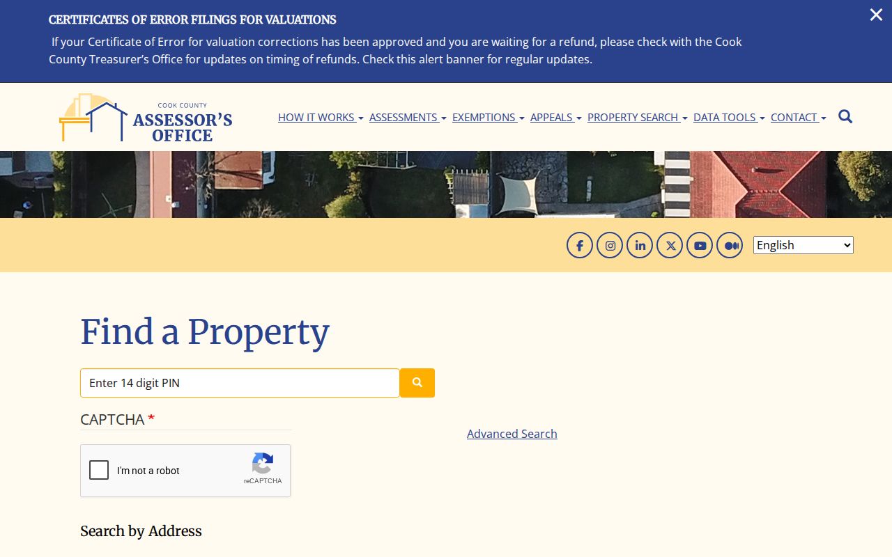
The captured form helps prevent a common failed search: putting a suffix into the street-name box or overlooking a unit number.
Map Orland Park Street Parcels
CookViewer searches by address, PIN, or intersection. Its Nearby Search begins with a selected parcel and radius, while historical parcel, aerial, and district layers add context. An address point can sit close to more than one polygon, especially around shared drives, outlots, and large sites. Click the legal parcel instead of accepting the first pin on the map.
Will GIS has parcel polygons, address points, streets, municipal lines, townships, PLSS sections, zoning, school and election districts, tax districts, and aerial imagery. PLSS means the Public Land Survey System, the grid used in many legal land descriptions. The catalog lists streets and address points as weekly updates and parcels as Summer 2026. These layers show land and boundaries, not the people inside a home.
The CookViewer parcel map is the Cook-side visual source for selecting nearby lots.
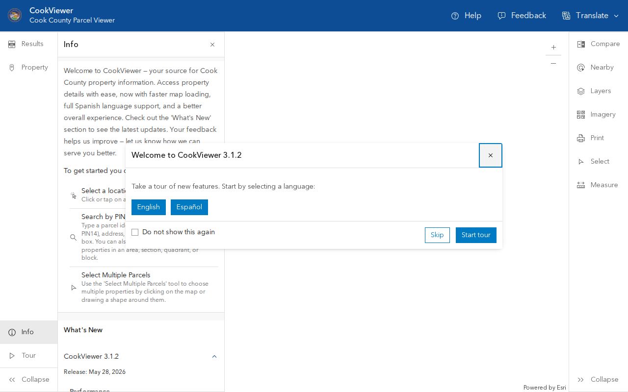
Its parcel selection and nearby tools turn one known address into a careful list of adjacent PINs for separate checks.
Orland Park Street Record Coverage
No single roll works as a complete street directory. The useful sets are keyed by parcel, address, named party, or known voter. Their access paths also differ by county. Use the map and assessor first, then move to deeds, permits, and older sources only when they answer the question at hand.
| Address source | Custodian | Street evidence | Access route |
|---|---|---|---|
| Assessment and tax records | Cook Assessor/Tax Portal or Will SOA | PIN, assessed party, values, exemptions, tax mailing fields | Free portal; township assessor handles Will corrections |
| GIS parcel map | Cook GIS or Will GIS | Parcel geometry, addresses, districts, aerial context | Free viewer; GIS office for nonposted data |
| Recorded instruments | Cook Clerk Recordings or Will Recorder | Deeds, liens, plats, mortgages, and recorded parties | Will index generally 1965-current; office and archive fallback |
| Voter registration | Illinois and county election offices | A match for one known voter and address | Single-person lookup; no public block browse |
| Permits and COAs | Orland Park Development Services | Project, inspection, applicant, contractor, historic review | Portal or address-specific request |
The PIN is the safest bridge. It links the parcel map and assessment card to recorded documents even when a street spelling changes. A name from a deed can then be checked against an obituary or old directory, but it must not be treated as proof of occupancy.
Decode Orland Park Address Terms
Address records use precise labels. Knowing them prevents the tax-mail destination from being mistaken for the house where someone lives.
- Parcel
- A legally described tract of land with its own PIN.
- Situs address
- The physical property location, which may differ from a postal or tax mailing address.
- Plat
- A recorded map showing lots, blocks, easements, and subdivision lines.
- Criss-cross directory
- A historical directory arranged by street address rather than only by surname.
A homestead exemption can be a clue that an owner claimed a residence-linked tax benefit. It still does not prove who occupied the parcel on a specific day. The Cook County Property Tax Portal adds tax mailing and five-year tax or exemption history to the Cook record trail.
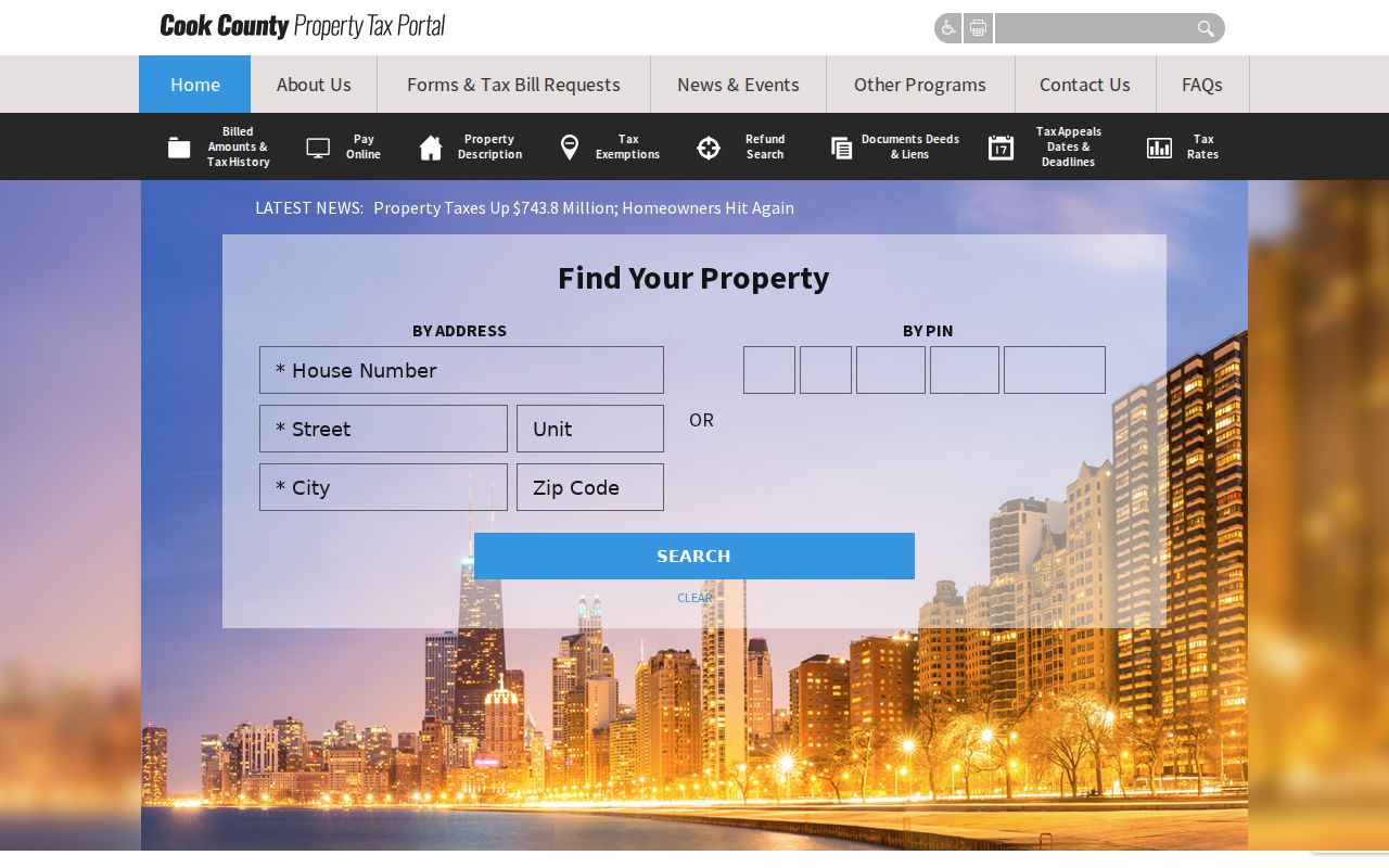
That second Cook source is useful for comparison, but its mailing field must remain labeled as mailing evidence.
Trace Orland Park Deeds
On the Will side, Direct Search accepts house number, street without a suffix, city, ZIP, PIN, party, document type, and date. A percent sign works as a wildcard, and the Recorder recommends a trailing wildcard for parcel or address variants. Search more than one way because the working index is not guaranteed to be error-free. Online coverage is generally 1965 to the present; older instruments require public workstations, microfilm, archive books, or an order based on a document number.
Begin with the newest deed. The grantor is the party transferring an interest, while the grantee receives it. Search the seller as an earlier grantee, then compare the legal description and PIN. Trusts, condos, subdivisions, and PIN splits can break a name-only chain. On the Cook side, gather the PIN from CookViewer and the assessor, then contact Cook County Clerk Recordings because the inspected recordings page did not expose a confirmed street search or online cutoff. Recorder duties moved to the Clerk on December 7, 2020.
Read Orland Park Permit Trails
Village permits can connect an address to an applicant, owner, contractor, plan, or inspection date. Development Services covers work such as additions, decks, fences, roofs, pools, HVAC, sheds, windows, and driveways. The public page does not document a searchable result grid, so request a permit history by address rather than assuming a complete online street search.
Old Orland has an added layer. A Certificate of Appropriateness is required for covered work in the historic district or on a landmark. Surveys from 1984, 1991, 1995, 2005, and 2008 include address, style, or year-built evidence. Development Services accepts records requests through the Village Clerk's Illinois Freedom of Information Act route when the file is not posted. Those surveys can bridge a modern street address to an older building description.
The inspection request fields show how the Village keys a project file. They include the permit number, street address, property contact name and phone, contractor, inspection type, and requested date. Those fields can define a narrow records request even though they are not a public resident index. Approved plans may be sent by email for some projects, while new residential, commercial, and fire plans must be collected in person. Ask for the address, permit type, and date span needed, not every file on a road.
Research Older Orland Park Streets
No authoritative source found a universal Orland Park renumbering project. Do not assign an old address a modern number by guesswork. The Village began as a smaller incorporated area in 1892, roughly bounded by 151st Street, 94th Avenue, 143rd Street, and West Avenue. Older tracts may sit in township, church, rural land, or county records before they appear in a Village series.
Ask the Orland Park Public Library Adult Services desk and Village Heritage Sites about local phone books, donated directories, plat books, historic surveys, and the digital archive. Exact local criss-cross years were not confirmed. The library's newspapers and local-history books are the better fallback, while IRAD and county archives can hold older tax, land, poll, and probate books. The Orland Park directory book collections provide the deeper historical shelf method once a relevant volume is identified.
The local grid gives useful search variants. Official records use numbered streets such as 143rd, 151st, 159th, and 183rd, along with routes such as West Avenue, Wolf Road, Ravinia Avenue, and La Grange Road. Try the numbered form and the road name without its suffix when a portal permits it. Then compare the result with a PIN. A grid address is a locator, not a legal description, and the same roadway can continue across a ZIP, county, or municipal edge.
Recover Missing Orland Park Records
A blank web result does not prove that no street record exists. Will Recorder documents are generally online from 1965 forward, but earlier instruments may remain in archive books or microfilm. Its office offers public workstations, an order desk, email or fax copy requests, and a FOIA form for administrative records. A requester who already has a document number can order an older copy. Plats may have broader historical coverage than the ordinary document index.
Cook County needs a different fallback. Recorder duties moved to the County Clerk in 2020, and the inspected Recordings page did not confirm its search fields or earliest online date. Take the parcel PIN, legal description, likely party name, and date range to Clerk Recordings. For nonposted map data, contact Cook GIS. For a Village permit, survey, map, or code file, route the request to the Village Clerk or the department that holds it under the Illinois Freedom of Information Act.
Older address evidence may require the library, Heritage Sites, a county archive, or the Illinois Regional Archives Depository system. Preserve spelling variants and the source date. Orland, Orland Park, Orland Hills, and nearby postal place names can create false matches in newspaper text. Cross-check each result against the parcel and county before adding it to a street directory.
Limits of Orland Park Street Records
A public street directory cannot identify every person in a home. Renters, roommates, children, guests, unregistered voters, and people protected through Illinois's Address Confidentiality Program may not appear. Utility customer lists and private household rosters were not found in the inspected public portals. Illinois driver address data is restricted. A deed names recorded parties; an assessor card describes a parcel; neither is a current household list.
The state voter lookup asks for a known person's name, birth date, ZIP, street number, and street name. It confirms a registration match. Illinois law restricts voter-file release and use, so the form must not be presented as a way to browse everyone along a road. When the goal is one known person instead of the full address chain, use the Orland Park resident lookup workflow.
Lawful use. Use Orland Park address records only for lawful personal research. Stalking, harassment, intimidation, and harm are prohibited.